Commission helps find best location for new Dennis fire station
The Cape Cod Commission Geographic Information System Department (CCC GIS) recently provided advanced analysis to the Dennis Fire Department to identify the optimum location of its second fire station.
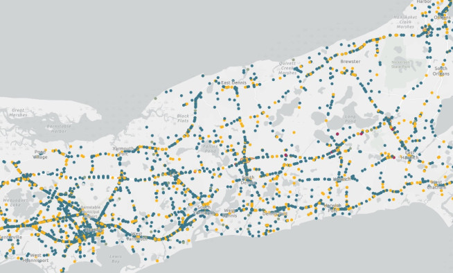
With the town’s existing Fire Station #2 deemed unsuitable for redevelopment, the department wanted to identify a site providing the best response time for the greatest number of Dennis residences north of Route 6. A baseline scenario was created using the department headquarters on Route 134 and the existing Station #2 on the northside as starting points.
Software used by Commission GIS staff can determine service areas along the road network at varying speeds in specified times from user-defined locations. The ability to run various scenarios quickly, changing factors such as facility location, greatly aided discussion of finding a location.
Cape Cod towns work both independently and cooperatively with the Commission’s GIS Department. Dennis GIS staff Alicia Messier was aware of the Commission’s GIS work from presentations at Cape GIS User Group meetings. When Dennis Fire Chief Mark Dellner approached her to determine a suitable site for a second fire station, Messier knew the Commission could help.
Working with Fire Chiefs across Cape Cod, an approximation of posted speed limits was assigned to roadways at specific intervals. The software calculates the service area, or time-of-travel zone, from the number of minutes in desired response times.
Working with Chief Dellner different scenarios and locations were developed throughout the project. The resulting analysis was reviewed by Dennis town staff.
“Leveraging the Commission’s software extensions and knowledge was a perfect GIS collaboration,” Messier said. “Dennis saved time and money and more importantly had a better way to make a more informative decision with relocating our Fire Station 2.”
Related Posts


