Updating the Ponds and Lakes Atlas
Cape Cod may be known for its proximity to the ocean, but it is also home to nearly one thousand freshwater ponds and lakes that provide a variety of distinct and important habitats for aquatic and terrestrial wildlife, plants, and insects. Many of Cape Cod’s ponds are part of an ecologically unique and globally rare community known as a Coastal Plain Pondshore. These communities provide habitat for state-protected rare plants. In addition, some of our freshwater ponds that are connected to the ocean support numerous fish and wildlife species, including important diadromous species such as river herring and American eels, which live in both fresh water and the ocean. The largest concentration of coastal plain ponds is found on Cape Cod.
Ponds are popular locations for a wide range of recreational activities, including hiking, swimming, boating and fishing. They also serve an important role as one of the few areas throughout the landscape that provide suitable conditions for natural nitrogen removal. Healthy ponds help to reduce the amount of nitrogen ultimately being delivered through the aquifer to our coastal waters.
The majority of ponds on Cape Cod are kettle ponds, formed when massive glacier ice blocks melted, resulting in holes that filled up with fresh water. These kettle ponds are both fed by, and contribute to, the groundwater aquifer. Because of this relationship, when studying or observing ponds above ground, we are also indirectly examining what is happening below ground. In areas where widespread monitoring of groundwater is not occurring, monitoring of the ponds can give a sense of what is going on in the groundwater.
Cape Cod’s ponds are extremely fragile. Septic systems, fertilizers, and stormwater runoff have introduced excessive nitrogen and phosphorous to our ponds. This buildup of nutrients has led to a proliferation of algal blooms. While algae can be beneficial, providing food for fish and other wildlife, excessive algal growth can lead to decomposition and a depleted oxygen level in pond water that can kill fish and shellfish. Additionally, a small percentage of algae produce toxins that may be harmful to humans and wildlife.
Pond information, stewardship, and monitoring is highly fragmented throughout Cape Cod. The current Ponds and Lakes Atlas is often the best resource to point people to when they have questions about a specific pond or ponds, but the information it contains is nearly 20 years old.
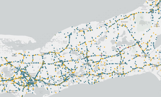
Commission staff is now working to update the Ponds and Lakes Atlas, and provide the information through an interactive, GIS-based online viewer. This new format will be easier for users to access and explore, and it will allow for information on ponds to be updated on a regular basis.
The update is an intensive process. Work is now being done to migrate existing information into a GIS database, and to compile all past and future pond water quality data in one central location, allowing stakeholders to access data to make informed, science-based decisions about pond management.
In addition to serving as a single resource for updated information about ponds, the Ponds Atlas will provide baseline information to inform a dedicated freshwater planning initiative. It may also serve as a means to connect interested parties to the people and stewardship organizations who are actively working in the ponds and help to identify gaps in stewardship and monitoring.
Related Posts


