Category: GIS + Geodesign
When creating digital plans, it’s essential to have an accurate representation of the natural and built environment. But how do you achieve that?
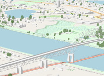
These representations of our landscape aren’t just developed on a computer screen—they are digitized versions of the real-world environment of the region. Planimetric data are digital points, lines and polygons representing features on the ground, such as manholes, coastal infrastructure and catch basins, that can be used in geographic information system mapping applications.
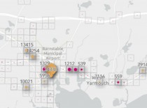
Passengers on Cape Cod’s public transportation network have a variety of ways to catch a ride, but by far, the most popular way is to flag a bus down anywhere along its route. While convenient, this method does pose some safety challenges. To help assess the most popular access points, the Cape Cod Commission and Cape Cod Regional Transit Authority collaborated to develop an online tool that, using ridership data from 2022, shows where riders are getting on and off the bus.
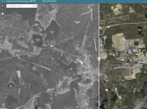
The Cape Cod Commission's Chronology Viewer enables users to view historic trends and aerial imagery from 1938 to 2020. It has recently been upgraded with a new look, updated data, and an easier-to-use interface.
There’s more to explore within the Cape Cod Coastal Planner, a decision-support tool that helps users understand the climate change hazards impacting Cape Cod’s coastline and some of the adaptation strategies available to address them.
To keep the community informed, the Cape Cod Commission partnered with Cape Cod Healthcare and the Barnstable County Department of Health and Environment in April 2020 to create an online COVID-19 community alert heat map system showing the numbers of confirmed cases of COVID-19 within Barnstable County. The Cape Cod Commission discontinued updating the application on January 31, 2023.
Many of the Cape Cod Commission's projects and initiatives include robust stakeholder engagement: public meetings, presentations, design charettes, and public comments. But the pandemic rendered in-person meetings infeasible. So how do you connect with stakeholders when you can't meet in person?
This month, the Association to Preserve Cape Cod (APCC) and the Housing Assistance Corporation (HAC) launched Grow Smart Cape Cod, a mapping project that illustrates priority areas for natural resource…
In November, the Cape Cod Commission took home two awards for GIS applications presented at the annual Northeast ARC Users Group (NEARC) Conference.
Web-based application designed to assist in appropriate siting of large-scale solar photovoltaic projects The Cape Cod Commission’s 2018 Regional Policy Plan identifies recommended actions to address major challenges facing the region, including climate…
